The Loughlinstown Camp
1795 - 1798
1795 - 1798
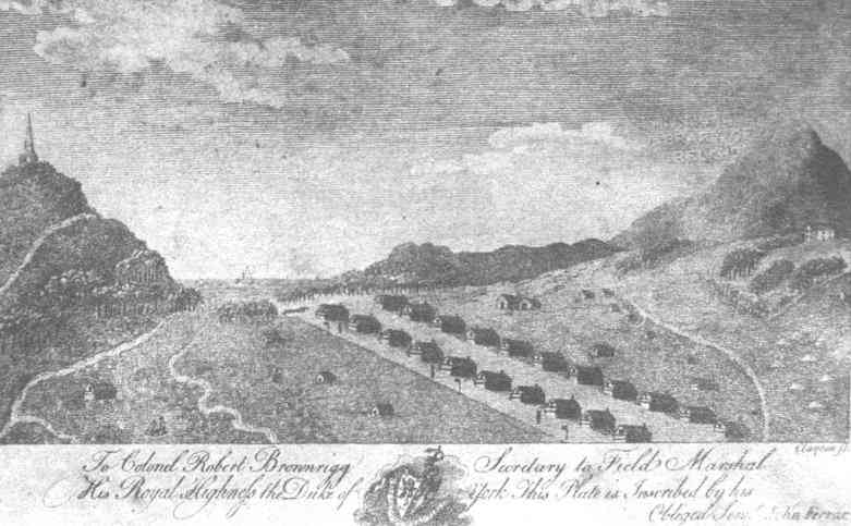
The image below is from John Ferrar's book in 1796. The style is typical of the period and is also reflected in the Galton prints of local views. The scenes are compressed and mountains magnified. This purports to show a camp which Ferrar estimated housed about 4,000 men at the time !
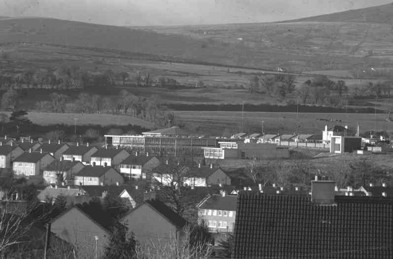
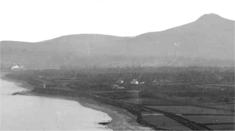
Below is a view of the camp area from Ballybrack village, taken in the 1970s. You can see St. Lawrence's college in the foreground. The fields directly behind the college are camp ground. Much of this land has since been developed or is in the course of development.
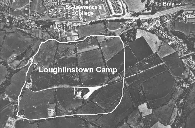
Below is an aerial view of the camp area (6" to 1 mile] taken in the 1970s by Fairey Surveys. I have marked out the approximate area of the camp. The top of the photo is east and the road, from left to right, is the dual carriageway from Dublin to Bray as it approaches Laughlinstown.
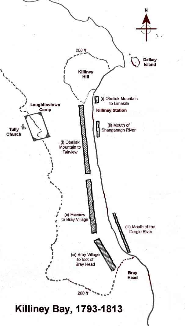
The map below shows the coastal and inland divisions identified by Major La Chaussée in his 1797 analysis. This pointed out the weaknesses of the bay in the event of a French seaborne attack and included his proposals for short term remedial action.
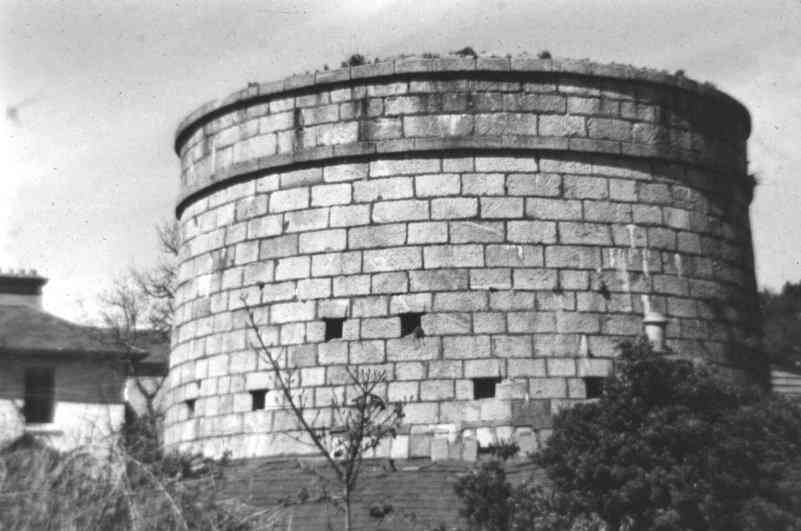
The Martello Tower, below, is located on Killiney Hill Road and is No. 7 in the sequence between Bray head and Dalkey Island. The series of martello towers and batteries, begun in 1803, were placed so as to give overlapping fire and, in particular, reinforce the defences of the weak points identified by La Chaussée. No. 7 is in the course of being fully restored by Niall O'Donoghue and will be a unique museum to the genre, when completed.
The scene below is a detail from a William Lawrence photo (3983 W.L.) taken possibly around 1890. It shows Tower No. 4, at bottom left. This tower was demolished after its supporting batteries fell into the sea due to coastal erosion. The site of the No. 5 Battery is also visible at the top of the cliff, at bottom right. It is cut through by the old railway line which was subsequently moved inland to avoid its sharing the fate of Tower No. 4.
A more extensive treatment of the subject is in my article .