The Dwyers of Cappanahanagh
 The search
I knew my father's people were not from Ballyhaunis. His father had been stationed there as an RIC constable so there were no roots. I figured they probably came from Co. Tipperary as Dwyer is a very Tipperary name. Cousin Colette (the repository) told me great granda had been a steward on an estate and cousin Michael (the frenchman in Maynooth) told me there were descendents called Meehans, who were undertakers, in Newport and that this is where we came from. This town is in Tipperary (just) and I wondered why, if they were from there, the granda had been recruited into the RIC from East Limerick. I was on a trip to Kilkenny recently, following up the Medlar/Brennan branch. I had looked up a Meehan phone number in Newport but was reluctant to cold call. While in Kilkenny, lo and behold, didn't I get an unsolicited email from Nora Meehan, who said she had been looking at my website and we were related. Not only that but she was living on the old homestead in Cappanahanagh, just inside the Co. Limerick border. Would I like to drop in when next in the area? I jumped (over-eagerly) at the offer and was on her doorstep the next day. Herself and husband John, the undertaker and blood relation, were great hosts. They filled me in on all sorts of stuff and brought me on a tour of the area showing me where the original house had been and where my folks were buried in one of the most peaceful graveyards I've seen in a long time. They also brought me to visit Nonie Ward who had known Johnny Dwyer, the last "Dwyer" who lived on the family patch. When Johnny came visiting his pockets were bulging with apples. He had the only orchard in the area. And to cap it all, who was recorded in the 1901 census staying with her grandparents? The elusive Jane Dwyer. I knew she had gone to the USA by 1911 but I expected to find her in Ballyhaunis in 1901 - no sign. I have since traced her passage to the USA which you can check out at the link above. A profusion of riches. The Cappanahanagh Homestead
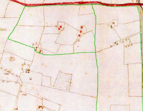
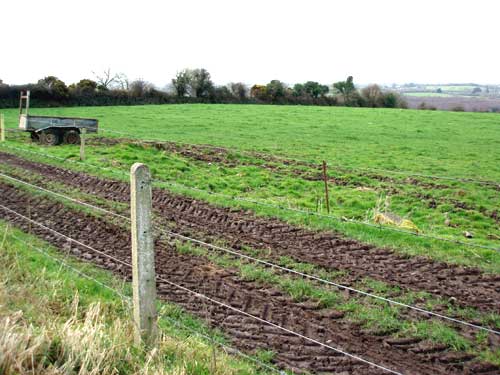 Unfortunately the old homestead is no more but, in keeping with the house style of this site, I am showing an up to date version of where it was (above). Fortunately, the Meehan's took a photo of it before it vanished and I have included this below. 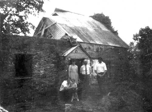 The house was clearly not in the best of nick at that stage, but I am told that there was a trend in later times to dispense with half the thickness of thatch and cover the remainder with galvanising. So this was clearly a trendy building at some point in its existence. The people in the photo are (right to left) John Meehan, the undertaker and my second cousin once removed, a visiting Yank, John's sister, Mary, her husband, Tony, and one of their children. Rest in Peace 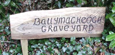 This is one of the most peaceful graveyards you are likely to come across. It is bordered by a stream which not only enhances the view but would send you to sleep with the gentle sound of the flowing water. The bird life is copious and very vocal and the entrance is guarded by a clatter of ruminant bovine militia. A sign warned of the bull, but he was known to John who determined he was not present for our visit. 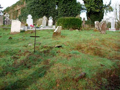 The Dwyers are buried in the foreground of this picture. John now owns the plot and it is his intention to put up a commemorative plaque at some stage. 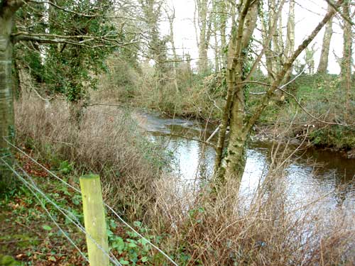 The stream that flows around the border of the cemetery 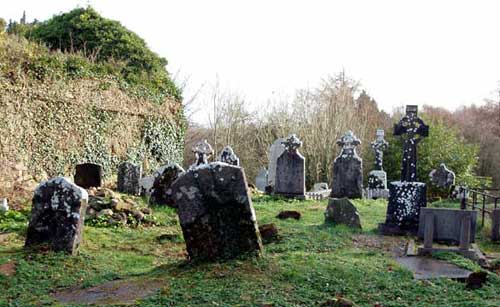 Silent Vigil 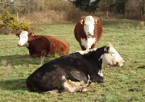 Ruminant Militia 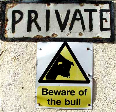 Absent Friend! The Tree 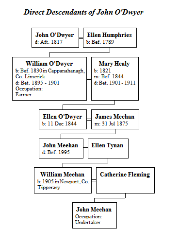 The tree above shows the descent from Ellen Dwyer (née Humphries) to John (my host) Meehan who now resides on the old homestead. You can see the same chart with siblings here. Two of Ellen Meehan's (née Dwyer) siblings were Michael Dwyer (my grandfather) and John Dwyer (aka Johnny) who was the one named Dwyer living on the homestead. John did not have any children. He intially brought his nephew Thomas Meehan from Newport to help on the farm, and later brought his grandnephew, William Meehan, father of John (the undertaker, and my host, who now lives there). [Note: the "O" in Dwyer comes and goes in different branches of the family. I have left it in in my family tree computer programme for the sake of consistency, though I sometimes refer equally to Dwyer and O'Dwyer in the text.] 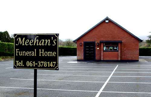 Thought you might like to see John's funeral home in Newport The Maps based on Griffiths (c. 1850)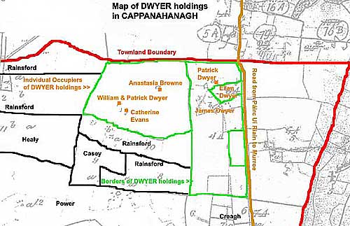 This is my overlay, based on a Griffiths map. It is difficult to match up the Griffiths numbering without corroborative evidence. It seems that Griffiths was a work in progress and the maps were in a state of constant change. However, the above probaly bears a reasonable relation to reality. The top boundary (red) is the northern limit of Cappanahanagh townland. Newport town is just a mile further up the road (brown). The green lines show the borders of the Dwyer holdings. The men, at this time, were William, Patrick and James. My feeling is that this William was my great grandfather and Patrick and James were his brothers. The women are intrigueing. Ellen Dwyer may well be the lads' widowed mother. If so, and assuming she was 20 when she had Patrick, who we know was born in 1809, her birth would take us back to the year of the French Revolution and she would have been 9 years old in 1798. But who were Anastasia Browne and Catherine Evans and what were they doing on Dwyer land? George and Thomas Browne held land in Cappanahanagh twenty years earlier and there was land in the neighbouring townland of Ashroe held jointly by Dwyer and Browne at that time. I wonder if Anastasia was originally a Dwyer and now a Browne widow resettled on Dwyer land. As for Evans, did Catherine Dwyer marry an Evans and was now resettled on Dwyer land? Some twenty years previously a Thomas Evans Esq. owned over 100 acres in Ashroe. [I'll follow this up in both Griffiths and the Tithe Applotments, but the above is probably an adequate working hypothesis for the moment.] |
From the Ordnance Survey (1841)
|
The actual 1840 OS shows the layout of the houses in greater detail. The green line again shows the borders of the Dwyer holdings. I have overwritten the few (top left) houses in red to indicate that they do not reappear in the 1900 OS. Clearly the holding was consolidating to its current position by that time.
|
From the Ordnance Survey (1900)
|
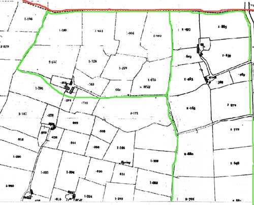
This shows the consolidation by 1900. There are also more fields marked out, but they may simply not have been recorded in detail in the 1840 map which was 6" whereas the 1900 is 25" to the mile. Also, in both maps I suspect the houses I have included in the bottom left of the Dwyer holdings may belong to the Rainsfords.
|
From Google Maps (2008)
Name of person under cursor:
Loading...
|
Unfortunately the Google map for this area is not great. The satellite pictures are fairly low definition and, while the outlines of the roads are correct, their naming and that of the townlands is a bit off the mark. Nevertheless, I'm putting up the map so that when Google upgrade you'll have it. At that stage I will re-align the permissable zoom on the limit of reasonable definition.
Incidentally Cappanahanagh is rendered in Irish as Ceapach na hAithne and explained as "the tillage-plot of the entrusting, pledge". |