Killiney Towers
Defending the Bay
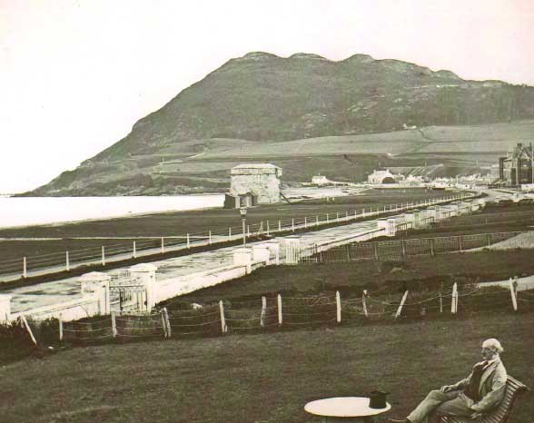
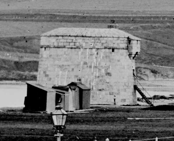
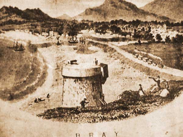
Tower No. 1 At the water's edge on the Esplanade in Bray. The absence of the cannon on the top dates it post 1866. The tower was demolished in 1884 and no trace of it remains.
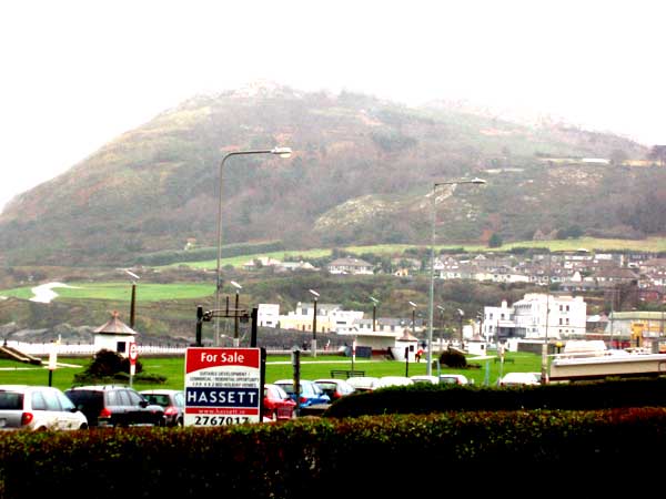
Tower No. 1 A contemporary photo taken from the same position. As far as can be determined, the original photo was taken from the grounds of what is now the Porterhouse Hotel.
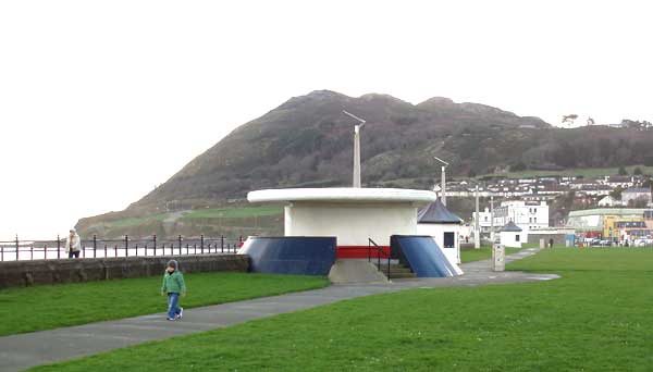
Tower No. 1 This round shelter might give the impression that it was on the site of the Martello tower, but the tower would have been slightly north and seaward of this actual position. There is no mention of the Martello on the shelter. It might be argued that, given the construction of the esplanade since the demolition of the original tower, the shelter is as close as possible to the original position as can be achieved in today's conditions.
Tower No. 1 This shot seems to be the same as the first one above though it comes from a different source and is of much better quality. If this is the case the first example above was nicked as I have seen the original of this one. This shot is from the WL Lawrence stereo pairs and was most likely taken just before the demolition of the tower in 1884.
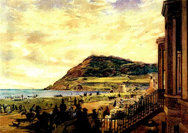
Tower No. 1 This painting from 1862 by Erskin Nicol shows the cannon still in place on top of the tower.
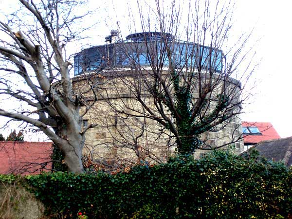
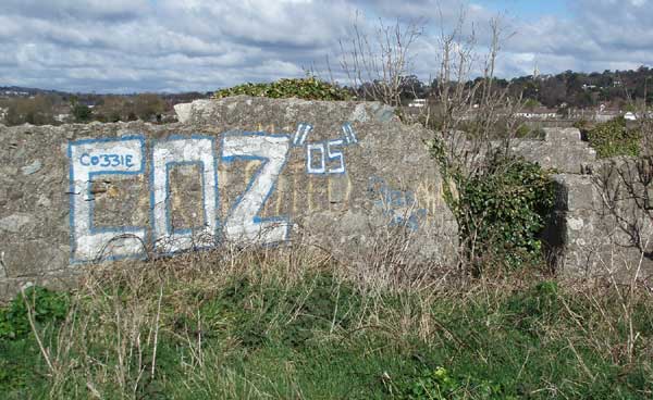
Tower No. 2 At the harbour in Bray. The tower is still there. A military man who owned it at one stage put the extra sun storey on it and when Bono lived there he darkened the glass.
Tower No. 3 At Cork Abbey no longer exists. It was either demolished or fell into the sea.

Tower No. 3 The map above (c. 1840) shows the location of the tower. Cork abbey is in the bottom left corner.
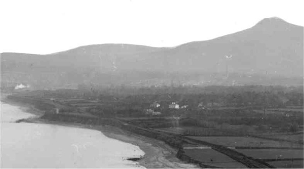
Tower No. 4 On Maghera point is clearly seen in this Lawrence print from the late 19th century. It no longer exists having fallen victim to coastal erosion.
No. 5 This is part of the remains of the battery which existed on the site. There was no Tower at this site. The battery was dismantled by 1815 as noted in the military Map of the Southern District of that year.
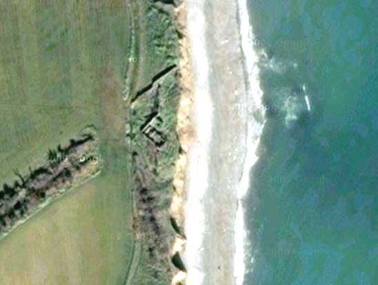
No. 5 Hover the cursor over the image to overlay a siteplan of the battery on the Google map sattelite image. The coastal erosion, which was at a much earlier stage in 1815, is clearly to be seen, though it has had another 190 years to advance since the dismantling of the battery. The open ground directly behind the guard house is the route of the old railway (from 1854 to 1914).
No. 5 Hover the cursor over the image to overlay a siteplan of the extended battery on the Google map sattelite image.
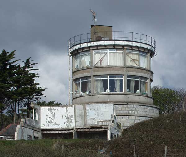
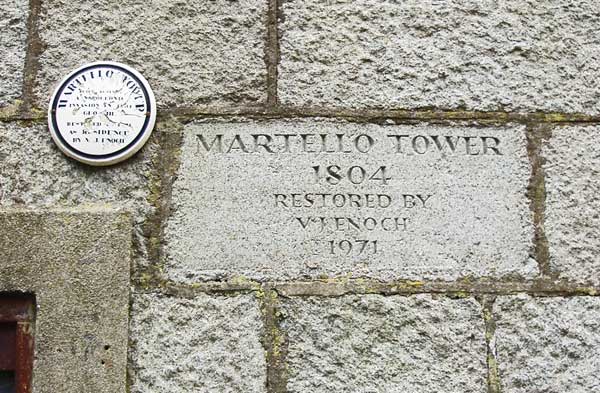
Tower No. 6 A view from the seaward side. This tower was inhabited by Miss Tombe in the 1950s and 1960s. It was bought by Victor Enoch who added the two upper sun storeys and reduced the tower itself into insignificance. Subsequent building in the grounds which has now become a ruin definitively takes from any appeal this sight might have retained.
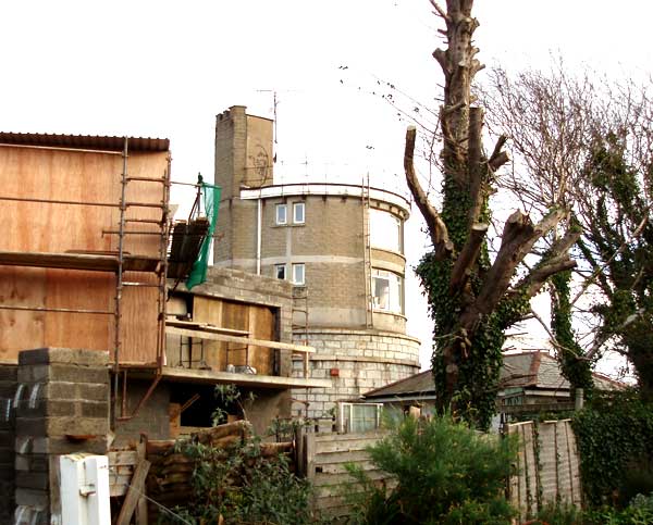
Tower No. 6 Further building on the landward side simply adds to the confusion and downgrading of the tower.
Tower No. 6 What must be the biggest piece of brass neck in the Bay if not in the whole country
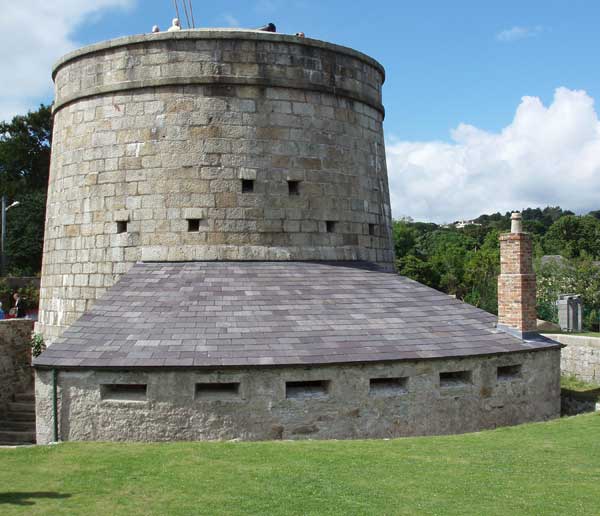
Tower No. 7 Near the junction of Killiney Hill Road and Killiney Avenue, this tower has been magnificently restored by Niall O'Donoghue. The work took over a decade and includes the gunners cottage, magazine, glacis, and battery ground.
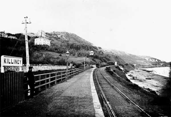
No. 8 This position was purely a battery. With the arrival of the railway in 1854-6 it became the (more or less) first Killiney station.
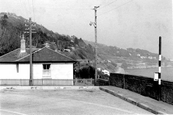
No. 8 When that station became obsolete in 1882, it became the stationmaster's cottage. It is now a private residence unrelated to the railway.
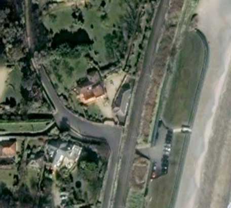
No. 8 Hover the cursor over the image to overlay a siteplan of the battery and military ground on the Google map sattelite image. Clearly the military ground extended right down to the beach. It is also worth noting that there was no Station or Strathmore road at this position while the battery was there. The pathway that now passes just seaward of what was the old battery is the current railway line.
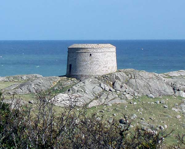
Tower No. 9 This magnificent specimen on Dalkey Island completes the ring of defensive positions in Killiney Bay. It was accompanied by a battery (below) which must be one of the best preserved in Dublin Bay, and possibly elsewhere in the country.
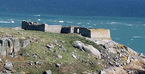
The isolated location may explain the good condition of both these buildings.
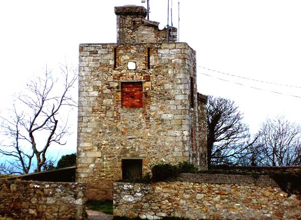
Telegraph Station While this is not strictly speaking part of the Martello programme, it does appear on the 1815 Military Map of the Southern District 1815 as an active Signal Station. It is located on Dalkey Hill and in modern times, appropriately enough, keeps watch over an aircraft approach beacon.
Kathleen Turner includes a commentary on all of the emplacements in the southern half of Dublin Bay in her book If You Seek Monuments (1983) and this is included in the extract here.